Robert Louis Stevenson and his journey through the Cévennes
In 1878, the Scottish writer Robert Louis Stevenson undertook a 12-day walk through the Cévennes, accompanied by a she-donkey called Modestine which he bought at Le Monastier-sur-Gazeille. This 220-kilometre journey, which he recounted in his work Travels with a Donkey in the Cévennes (1879), is considered one of the first accounts of modern trekking. Stevenson was 28 years old.
He passed through Le Monastier, Langogne, Cheylard-l'Évêque, La Bastide-Puylaurent, Florac, and descended towards Saint-Jean-du-Gard through the Gardon valley, passing within a few kilometres of what is today the Ferme de la Frégère Basse.
Modestine, the she-donkey who made history
Modestine was a small grey she-donkey, bought for 65 francs at the start of the journey. Stevenson describes her as stubborn and slow, yet ultimately endearing. She carried his luggage - a specially made travel bag - and trotted stoically along the mountain paths.
At the end of the journey, Stevenson sold her for 35 francs and admitted to shedding tears as he parted with her. "A lady of a certain age, wayward in her habits but gentle at heart" - that is how he describes her in his notebooks.
The story of Modestine perfectly captures what the relationship between a hiker and a donkey really is: an unlikely alliance that transforms into deep companionship.
The GR70: the Stevenson Trail today
The GR70, known as the Chemin de Stevenson (Stevenson Trail), faithfully follows the route taken by the writer in 1878. Stretching 252 kilometres, it links Le Puy-en-Velay to Pont-Saint-Esprit through the Cévennes. It is today one of the most walked long-distance trails in France, with several thousand walkers every year.
The section that crosses Vallée Française, between Cassagnas and Saint-Jean-du-Gard, is one of the most beautiful and wildest stretches of the route. It is precisely on this section that the Pont de Burgen gîte (point 120 in the FFRandonnée topo guide) and the Ferme de la Frégère Basse are located, 23 km from Cassagnas and 18–21 km from Saint-Jean-du-Gard.
The Cévennes: an exceptional territory
The Cévennes National Park
Created in 1970, the Cévennes National Park covers 930 km² at the heart of the Massif Central. It is one of the rare French national parks with a permanent human population - a unique feature that led to its designation as a UNESCO Biosphere Reserve in 1985. The territory is marked by exceptional biodiversity: century-old chestnut forests, gorse heathland, upland meadows, crystal-clear rivers. Vallée Française, where our gîtes are located, is one of the most preserved valleys in the Park.
Vallée Française
Vallée Française (the commune of Saint-Etienne-Vallée-Française) is a steep-sided valley in the southern Cévennes, through which the Gardon de Saint-Martin flows. At an altitude of 300–500 m, it enjoys a Mediterranean microclimate that makes hiking comfortable from April to November. Chestnut trees are everywhere - the chestnut was for centuries the "bread tree" of the Cévenols. The valley is among the best-preserved areas of the Park, with near-zero light pollution, making it a recognised Starry Sky Reserve.
Cévennes wildlife and flora
On your hikes you may encounter deer, roe deer, wild boar and perhaps a griffon vulture soaring above the ridgelines. The flora is equally remarkable: wild orchids in spring, heather in autumn, broom in summer. The Park's rivers - the Gardons - offer magnificent swimming spots with crystal-clear waters.
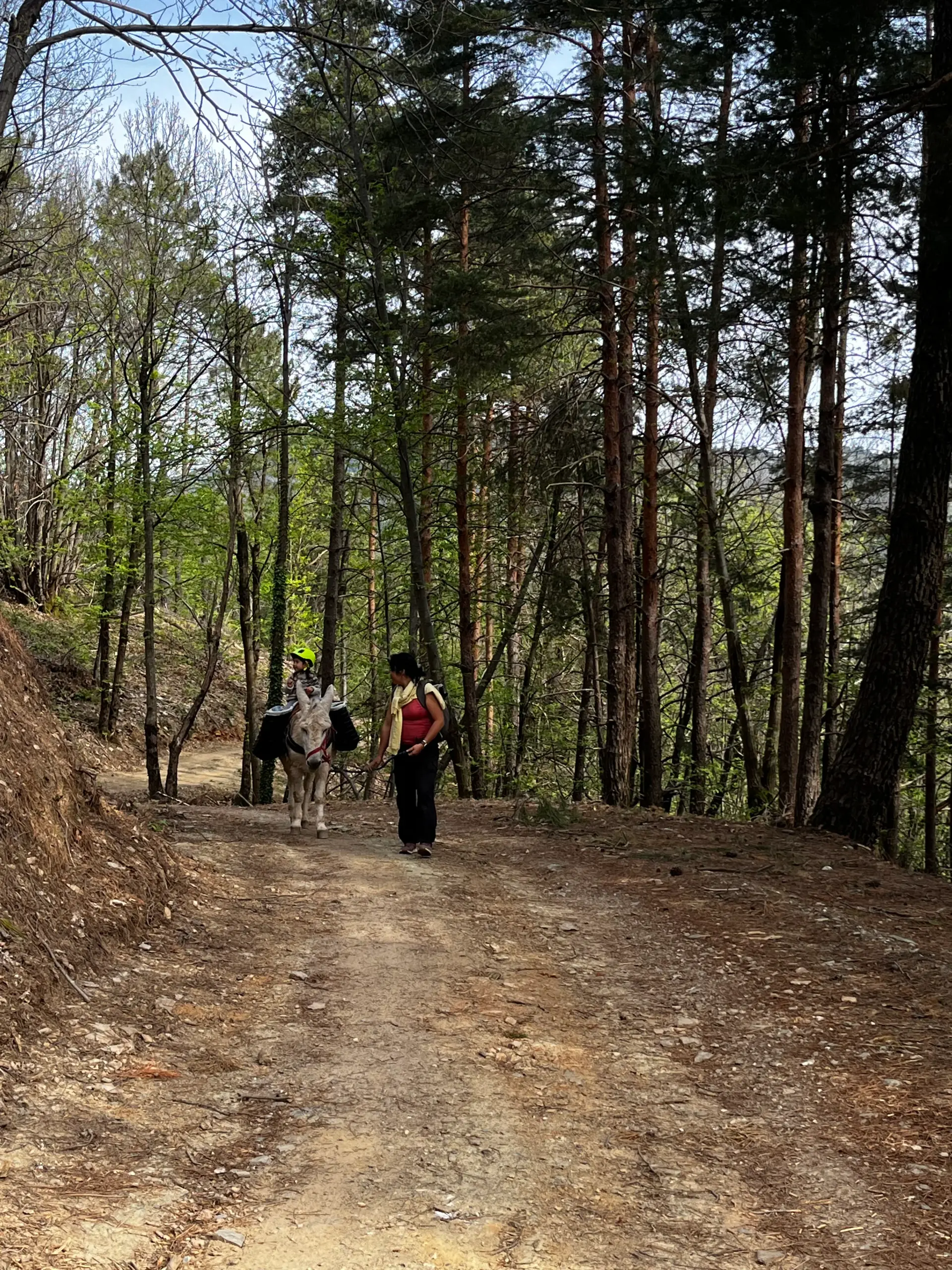
Hiking in Stevenson's footsteps with a donkey
Walking the GR70 with a pack donkey is to reconnect with Stevenson's original experience. It means letting your big-eared companion carry the bags, slowing the pace, taking the time to drink in the landscape.
The Pigache family, settled in Vallée Française for over 45 years, invites you to relive this adventure on the most beautiful sections of the trail. The Pont de Burgen gîte is moreover an official member of the Association Sur le Chemin de Robert Louis Stevenson (cheminstevenson.org), which brings together the accommodation providers and operators along the GR70.
How to reach us on the GR70
Our Ferme de la Frégère Basse is located 2.5 km from the Pont de Burgen gîte, which is itself 500 m from the GR70 (point 120). If you are walking the Stevenson Trail, we are your natural stopping point between Cassagnas and Saint-Jean-du-Gard.
The IGN map 2740 ET TOP 25 covers our area.
GPS Pont de Burgen: 44.19196 / 3.84392